Unlocking Geospatial Insights with FlyPix AI: Revolutionizing Object Detection and Analysis
TL;DRFlyPix AI has never been more essential for unlocking geospatial insights. This innovative tool offers advanced object detection, precise localization, and dynamic tracking capabilities, making it an indispensable choice for industries such as agriculture, construction, and renewable energy. With its intuitive interface and no-code approach, FlyPix AI empowers users of all technical backgrounds to create custom detection models for their unique use cases. By leveraging advanced deep learning models, FlyPix AI transforms complex imagery into actionable intelligence, providing detailed object analysis, change and anomaly detection, and heat map creation. This cutting-edge AI solution accelerates geospatial data analysis, ensuring rapid extraction of valuable insights and delivering cost savings through automated analyses. Whether you're monitoring crop health, inspecting construction sites, or tracking environmental changes, FlyPix AI is the perfect tool to transform your approach to geospatial analytics.
2023-02-07
Transforming Geospatial Insights with FlyPix AI
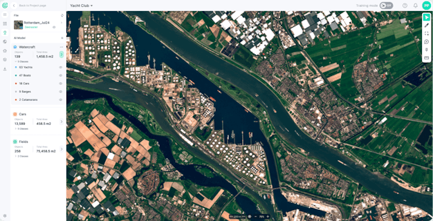
FlyPix AI is a revolutionary AI tool designed to transform complex geospatial data into actionable insights. This cutting-edge solution simplifies and enhances various geospatial processes, offering a unique blend of advanced AI capabilities and user-friendly functionality. Whether you're in agriculture, urban planning, environmental monitoring, or construction, FlyPix AI empowers users to unlock valuable insights with unparalleled precision. One of the key benefits of FlyPix AI is its no-code approach, which allows users of all technical backgrounds to create custom detection models for their specific use cases. This feature not only reduces the barrier to entry but also increases the efficiency and accuracy of geospatial data analysis. Additionally, FlyPix AI supports a wide range of image types, including RGB, multispectral, hyperspectral imaging, LiDAR, and SAR, making it a versatile tool for processing both satellite and aerial imagery. To provide a more in-depth understanding, here are 8 key features that make FlyPix AI an indispensable asset for geospatial analysts in various industries:
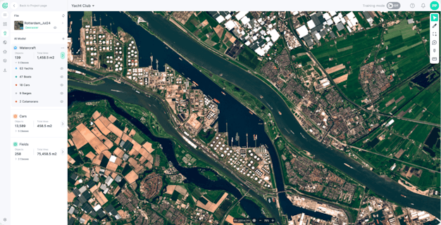
FlyPix AI uses advanced deep learning models to detect and segment objects in satellite and drone imagery, providing precise object localization and tracking.
The platform offers a user-friendly, no-code approach, allowing users of all technical backgrounds to create custom detection models without needing coding expertise.
FlyPix AI tracks changes and identifies anomalies in geospatial data, enabling users to monitor shifts over time and detect unusual patterns.
Users can create custom models tailored to their specific geospatial requirements, addressing unique use cases and enhancing the tool's adaptability.
FlyPix AI supports a wide range of image types, including RGB, multispectral, LiDAR, and SAR, making it suitable for processing both satellite and aerial imagery.
The tool generates heat maps for data visualization, providing a clear and intuitive way to understand complex geospatial data.
FlyPix AI dynamically tracks object properties and locations, offering real-time monitoring and efficient data analysis.
The platform offers scalable pricing plans that range from 10GB to unlimited data storage, ensuring flexibility for various user needs.

- Advanced Object Detection Capabilities
- Intuitive User Interface for Clear Geospatial Data Visualization
- AI-Powered Change and Anomaly Detection for Unusual Patterns
- Dynamic Tracking of Object Properties and Locations
- Customizable Models for Unique Use Cases
- Limited Integration Options with Other Apps
- No Free Version Available
- Potential Complexity for Non-Technical Users
- Limited Support for Mobile Devices
- Higher Starting Price (€890/month) compared to some competitors
Pricing
FlyPix AI offers a free basic plan, a Starter plan at €50/month for one user seat, a Standard plan at €500/month for two user seats, and a Professional plan at €2000/month for five user seats. Each plan includes access to FlyPix AI models, AI model training, AI model prediction/detection, and access to the Analytics dashboard. The Standard and Professional plans offer additional features such as multispectral data support, export vector layers, and advanced collaboration tools. Discounts are available when billed annually.
Subscription
TL;DR
Because you have little time, here's the mega short summary of this tool.FlyPix AI is a cutting-edge AI tool that transforms geospatial data into actionable insights through advanced object detection, localization, tracking, and monitoring capabilities. It offers a user-friendly interface, supports various image types, and provides custom model creation, making it a versatile solution for industries like agriculture, urban planning, and environmental monitoring.
FAQ
FlyPix AI offers flexible pricing plans starting from €50.00/month, including a free version and subscription-based options. A free trial is also available, providing users with an opportunity to test the platform before committing to a paid plan.
FlyPix AI is suitable for self-employed individuals and businesses ranging from 2–10 employees to over 5,000 employees, including geospatial analysts, surveying professionals, and GIS experts.
FlyPix AI supports English and German languages, making it accessible to a broader audience.
There is no specific information available regarding mobile device support for FlyPix AI.
FlyPix AI provides comprehensive support including email/help desk, FAQs/forums, knowledge base, phone support, and chat options to ensure a seamless user experience.


 Skip to content


How would you rate FlyPix AI?